Information Builders partnered with Environmental Systems Research Institute (ESRI) to build a solution for integrating Locational Intelligence with Business Intelligence. There are mainly three types of reports generated by using the mapping interface:
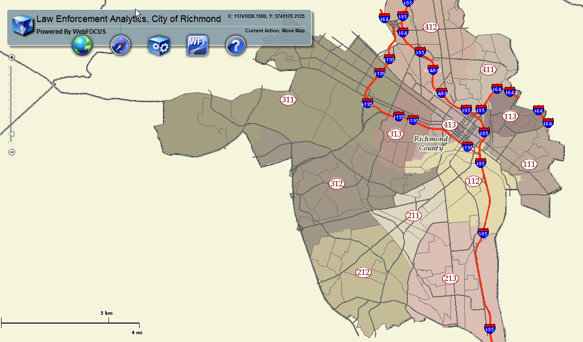
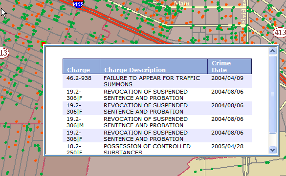
Using a mapping interface users can create a where clause using location to drill down to a WebFOCUS report (Picture 1). Map reports are generated by drilling down from a map (Picture 2). This allows the users to visualize results from a WebFOCUS report on to a map by using color, size, picture, and shape to define data represented on the map. The identify reports are single location based queries (Picture 3). Once the user clicks on a particular location, the map receives information back from the Reporting Server to display the information in contextual windows on the map, such as callouts and ToolTips.
Picture 1: WebFOCUS Report
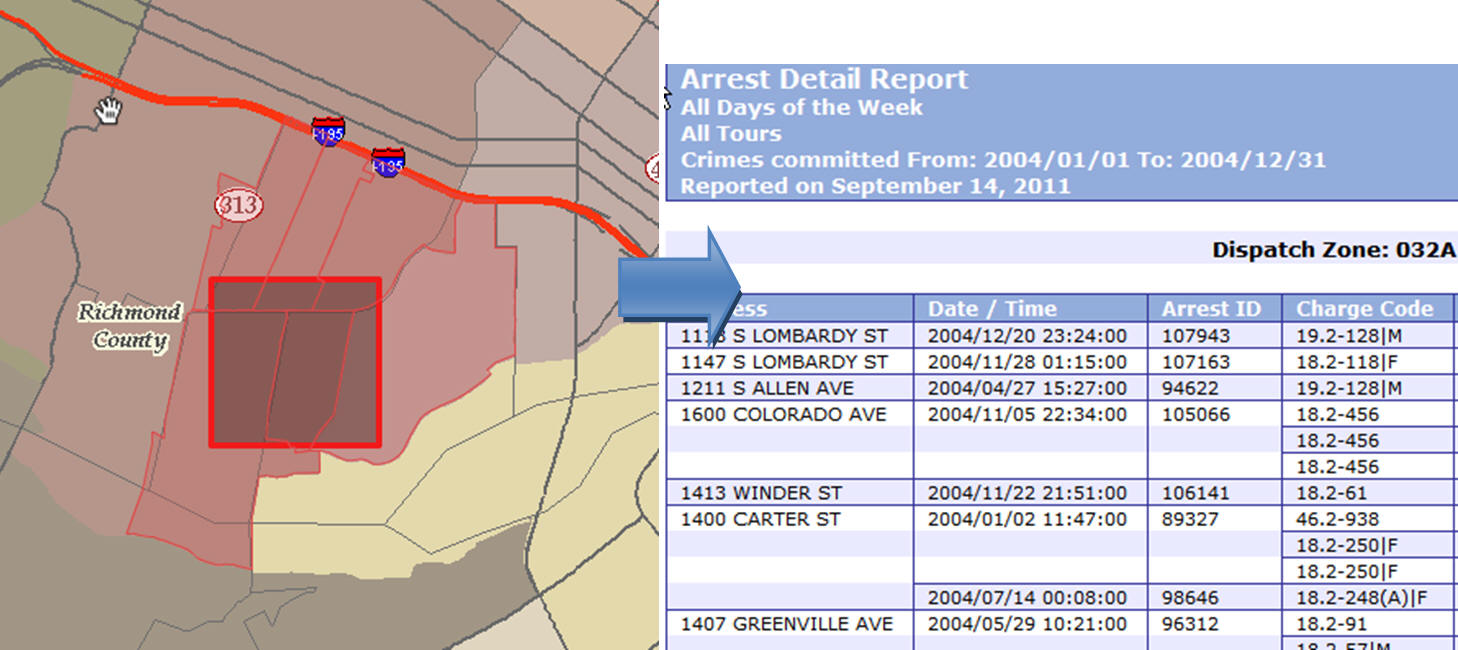
Picture 2: Map Report
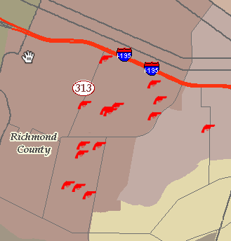
Picture 3: Identify Report
The four major blocks in this integration are:
Client
The client is the piece of the software that is facing the user. In our case of implementation, we chose Adobe FLEX®, an open source framework to develop Rich Internet Applications. When a user makes a request using the Web browser, this is passed on to FLEX to create a selection request to the ArcGIS Server. The client also processes responses back from the ArcGIS Server to pass on to the middle tier. Any symbolization (painting Map) happens in this framework.
Middle Tier (WebFOCUS Adapter for GIS)
The middle tier is the gateway to make requests to the WebFOCUS Reporting Server and receive responses back from the Reporting Server. Any response back from the Reporting Server is processed either to the Web or on to the Client.
ArcGIS Server
ArcGIS Server is a server-based product developed by ESRI. It allows users to publish maps on to the Web. The ArcGIS Server processes any user selection on the map. The map usually has some data layers, for example, streets, neighborhoods, arrests, and so on. Based on the location of these layers, the ArcGIS Server performs spatial filtering and returns a response back to the Client. This response is in the form of JSON formatted text. The Client uses this text to make further requests.
WebFOCUS Server
The WebFOCUS Server is the Reporting Server for WebFOCUS.
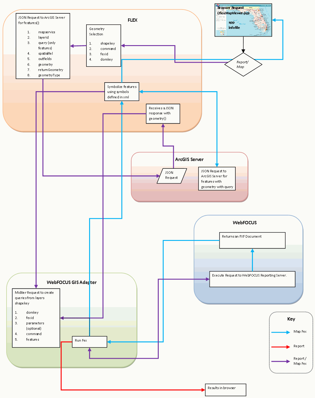
The diagram (Picture 4) below overviews the work flow between the different blocks of integration. The line connections between different entities can be either uni-directional or bi-directional. The function calls for the middle tier are clearly stated.
Picture 4: Software Architecture
| WebFOCUS |