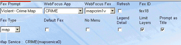
Normally the AXL file for the map service being accessed controls which map layers are visible. You may encounter a situation where it will be necessary to dynamically control layer visibility.
Clicking the Limit Layers check box on will cause the adapter to display only the layers that are listed within the OUTBOUND area. Any layer that you want to display, which has no features to be rendered must have the attribute name value left blank.
Ensure that the "Limit Layers" check box is selected to specify that only the layers listed in the Outbound section are rendered.
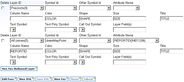
In the Outbound layer example above the Precincts layer is specified to be visible. No features on the Precinct layer will rendered since the Attribute Name and Column Name are blank.
The All crimes layer will have features rendered since the Attribute Name and Column Name pairing is provided.
| WebFOCUS |