Observing a major increase in thefts throughout their city, a police department decides to purchase an ESRI geographic information system (GIS), and the iWay Technology Adapter for ESRI, so that they can efficiently evaluate resources and develop crime prevention strategies. The role of the iWay Technology Adapter for ESRI is to obtain latitude and longitude coordinates of the theft locations and deliver that information to the ESRI GIS database. Once in the database, the GIS links the spatial and descriptive information to perform a relational analysis of the theft data. The adapter also allows them to delete, update, and query crime records already in the ESRI database.
Through the adapter, they will create targets that connect to the geospatial data directory for geocoding information (a geocoding target) and to the ESRI database for delivering the geocoding data to the GIS (an ESRI Loading target). Once connected to a target, they can generate XML schemas for the request and response documents and business services that will contain the geocoding data and action instructions.
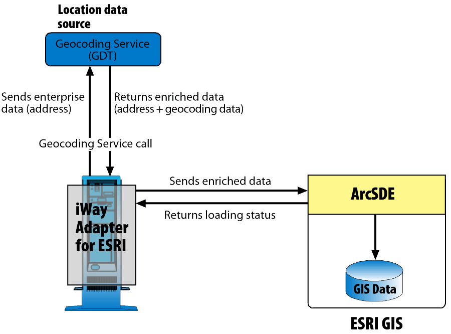
The following images shows an overview of the interaction between the adapter and the geocoding service, and the adapter and the ESRI database. As shown, the adapter sends enterprise data, in our example it is the address of the theft, to the geocoding service. The geocoding service returns the address and the geocoding data (latitude and longitude of the address) to the adapter. The adapter then sends this information to the ArcSDE server, which is the gateway to the ESRI database.
The following sections provide the XML request and response documents used to obtain the latitude and longitude of a theft location, and to deliver that information to the ESRI database.
| iWay Software |